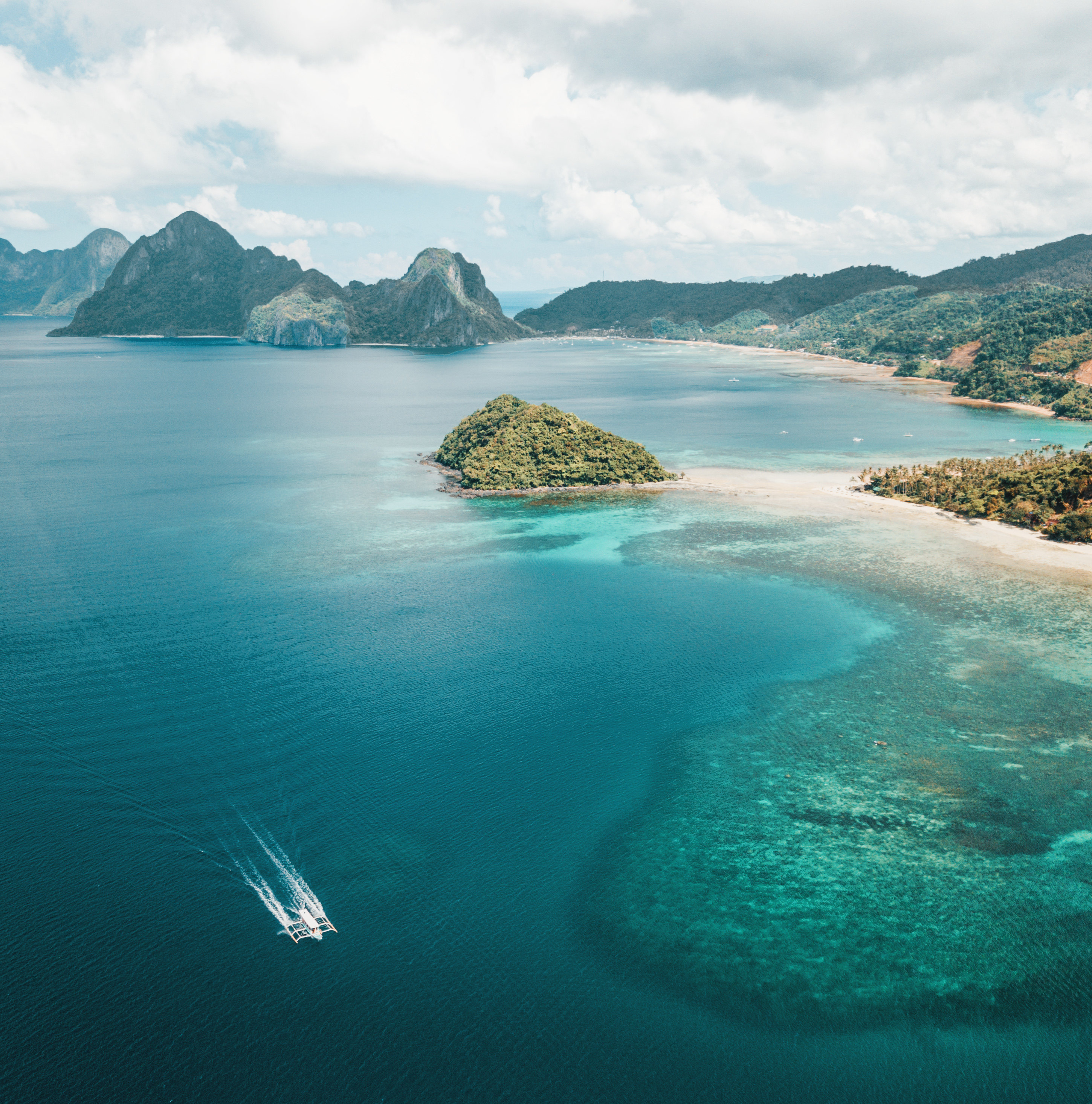
Scotland, until relatively recently, has perhaps been an underrated travel destination. Voted the most beautiful country in the world by Rough Guides Readers in 2017, the nation has recently seen a huge boost in recognition of its unparalleled beauty and rugged landscapes, which are entrenched in a fascinating culture and deep history. A vast country with lots to see, it can be tricky to plan a road trip that encompasses everything Scotland has to offer. Until maybe now…
In 2014, the North Highland Initiative established the North Coast 500. It is a circular route that skirts the very top of mainland Britain taking in fairy-tale castles, wild and remote beaches, and craggy mountain peaks. You can drive, cycle or even walk the route. However if you want to drive, it is best to pick up a car in Inverness to avoid having to drive to the start. There are plenty of car hire companies located in Inverness and the city has good transport links by plane or train.
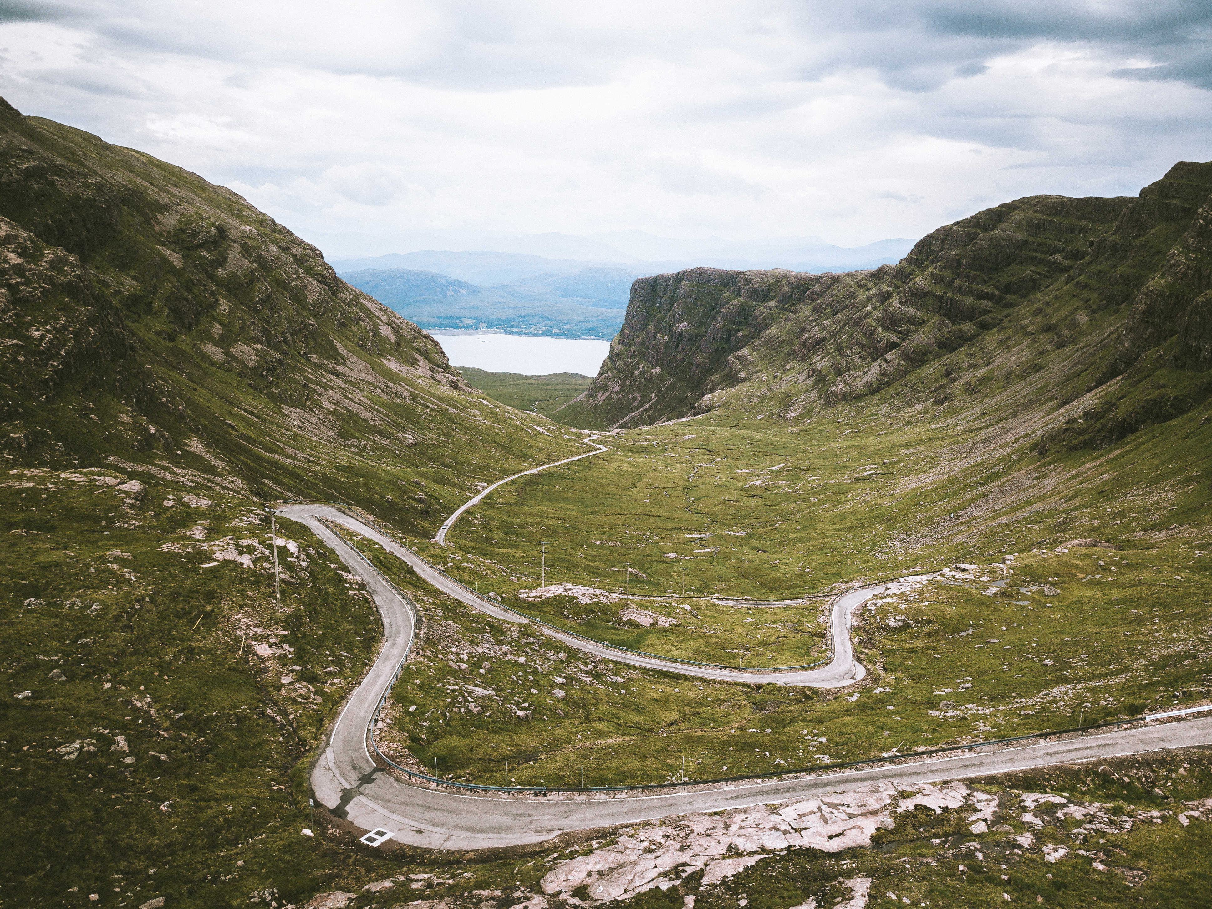
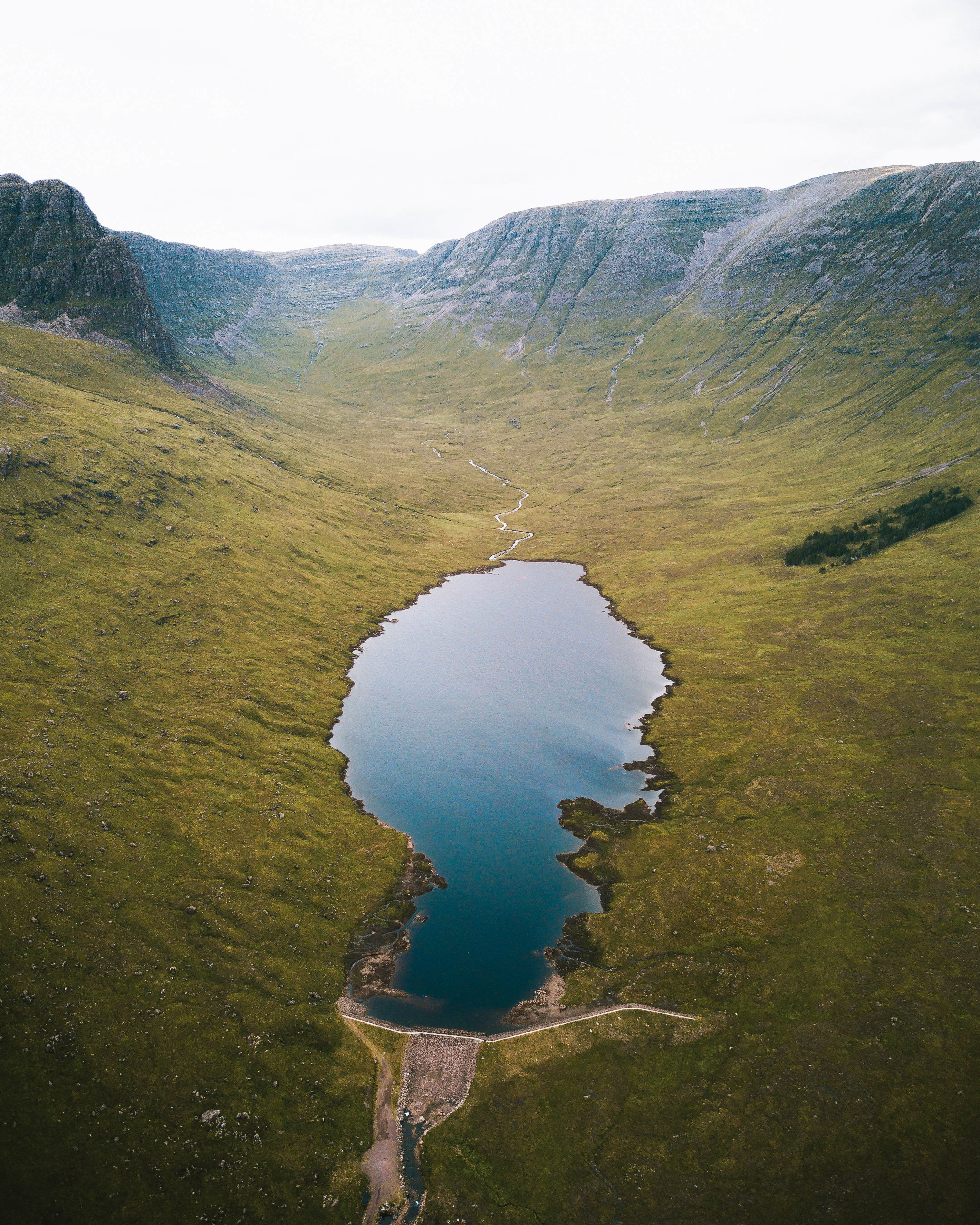
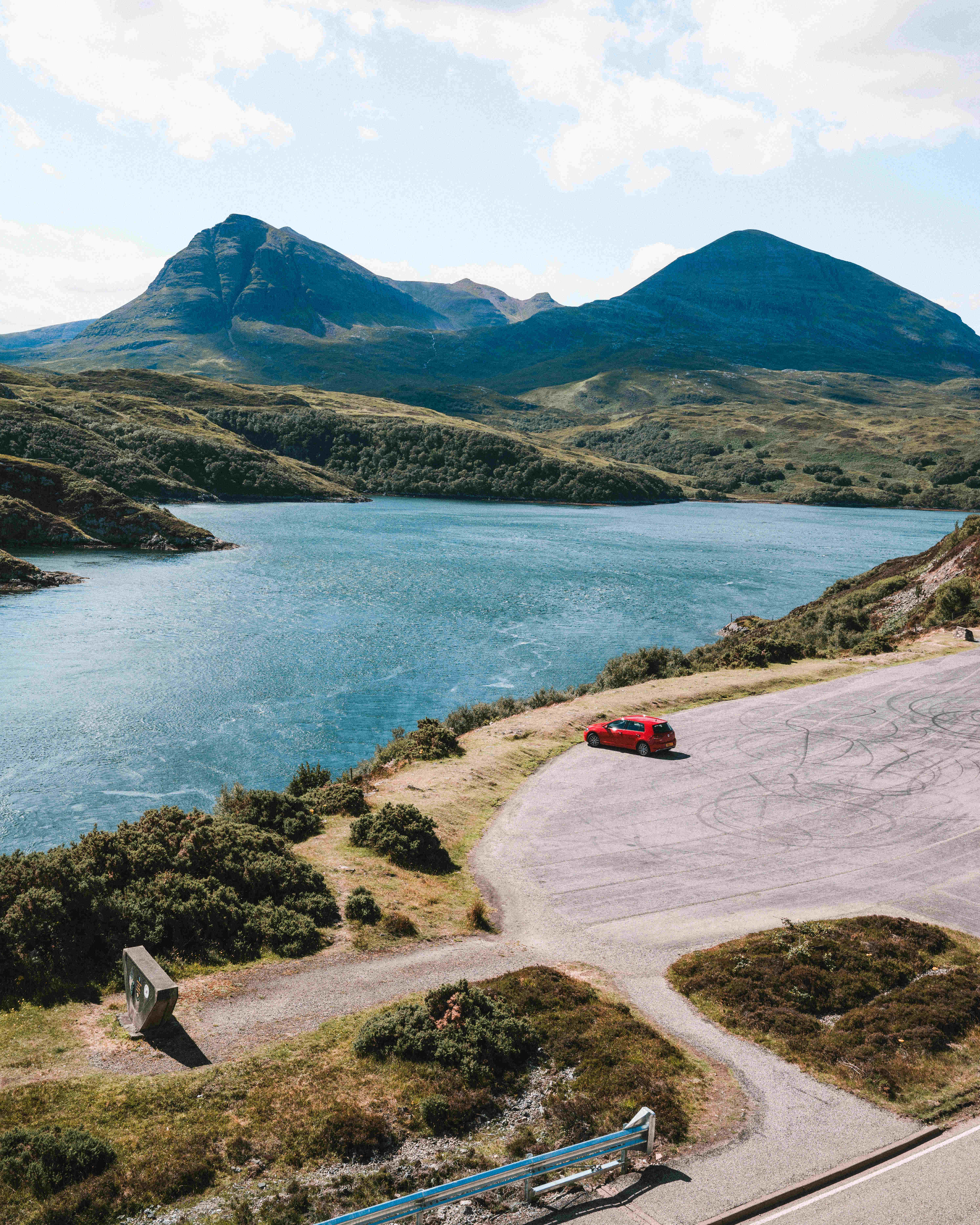
The start of the road trip sees you drive out of Inverness, across the water and onto the Black Isle; that is neither Black nor an Isle. Driving across the leafy peninsula the road begins to ascend and the Highlands start to emerge from the horizon. Once you turn off the A385 at Garve the true NC 500 experience begins to unfold. Follow the narrow winding road west, past Lochs and through glacial valleys. Upon reaching Ardarroch, a small hamlet on the shores of Loch Kishorn, you’ve truly reached the Highlands. From here follow the winding road of Bealach Na Bá (Pass of the Cattle) up over to Applecross. This twisting, single-track mountain road rises up to 626 metres (2,054 ft) above sea level, making it the third highest road in Scotland (pictured above). Prior to reaching the full ascent is an unsigned Loch, hidden just over the brow of a hill in the adjacent corrie, named Loch Coire nan Arr. A short walk from a narrow layby at the apex of the road, the Loch offers majestic views of the surrounding peaks with very few visitors.
From here carry on up the Applecross road to the top of the tight hairpins and park up to take in the incredible stretch of road. The road continues on down to the coastal town of Applecross, a perfect spot for lunch at the Inn by the sea. In addition to staying at the Inn, Applecross also has a campsite if you would like to spend the night here.
It is recommended that at least 3 nights and 4 days should be given for this entire trip, so it is worth considering where you would like to spend your time. However, regardless of the budget of your trip, there is a wealth of places for one and all. Wild camping is permitted throughout much of Scotland, including areas along the NC 500, so accommodation could cost you nothing if you have a tent, don’t mind skipping on the luxuries and obey the rules of wild camping. There are plenty of campsites located along the way, including within Ullapool (Broomfield Holiday Park), Durness (Sango Sands Oasis) and Torridon (Torridon Campsite) that all come with hot showers. There are plenty of B&Bs to be found along the NC 500 as well as some cosy Inns, Lodges and Hotels. There are also a number of Youth Hostels along the route in Torridon, Ullapool, Durness and Kyle of Tongue.
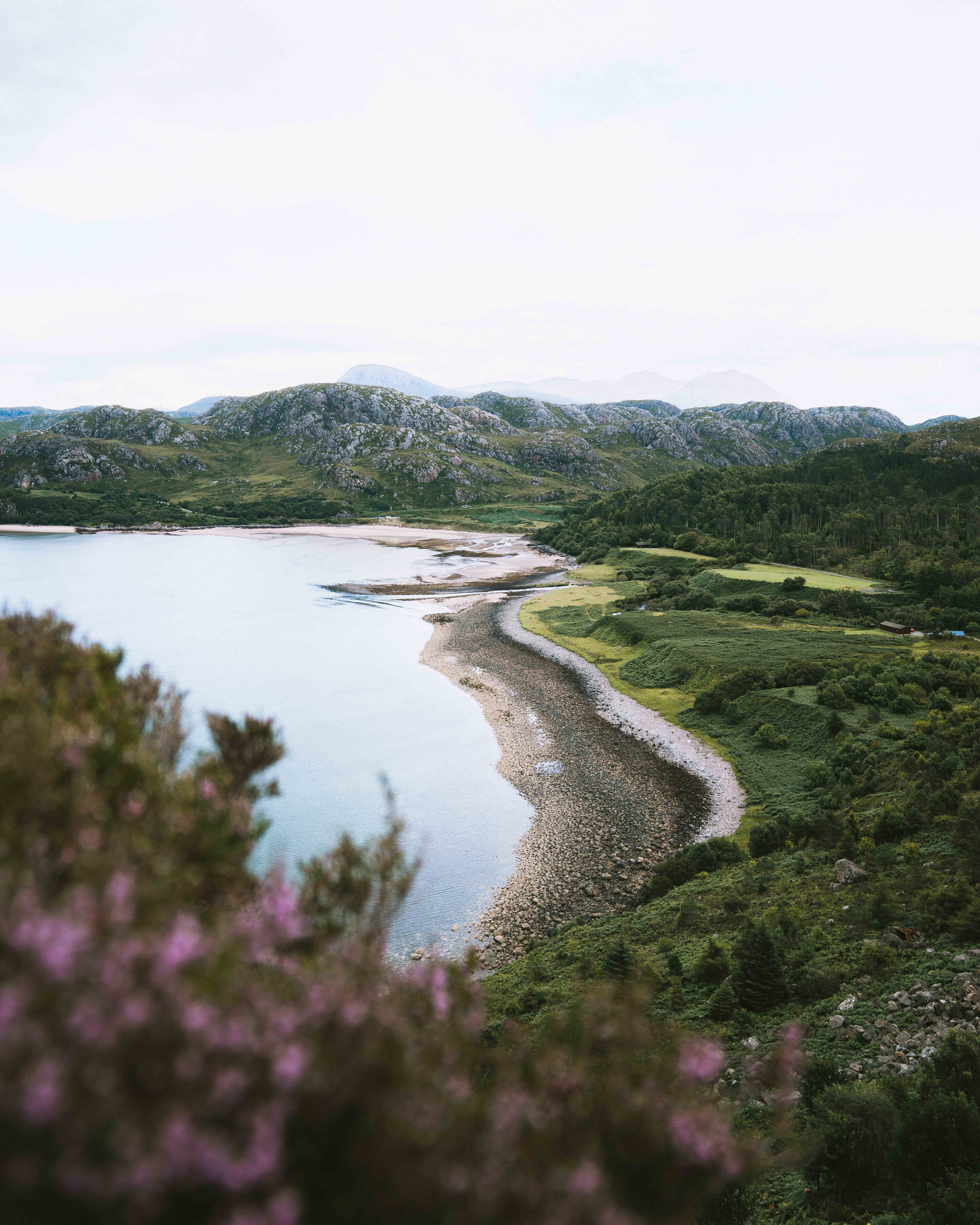
Driving out from Applecross, the road hugs the coastline and you can enjoy stunning views out to the Isle of Skye, Raasay and Rona to your left. As you round the headland you begin to make your way into Loch Torridon. Torridon is home to some of the most iconic Highland peaks and is considered by many to embody the North Highland landscape. A paradise for walkers, this is arguably THE place to go hiking on your trip. The hike up Beinn Alligin is a tough one, but in good weather, offers some of the best views across the Highlands.
From Torridon, the road begins to weave in and out of the coast, as the complex and wild landscape unfolds around you. Keep an eye out for deer, squirrels, pine martens, birds of prey, seabirds, and sea mammals such as dolphins, whales and seals. You’ll be bound to see a few sheep and most likely a few Highland Cows in the adjacent fields. As you round the corner at Laide, the ocean will open up to your left as you past by the Hamlets of First Coast and then Second Coast. Before driving down into Gruinard, stop at the layby (marked on the map below) and take in the spectacular view over the bay and perhaps eye up one of the beaches for a paddle. With parking just opposite Gruinard Beach, you’ll be in wonder of how this exquisite spot exists in Scotland, and why doesn’t everyone know about it! That’s also a thought that will likely cross your mind a number of times throughout this trip.
Ullapool is the next major settlement along the NC 500. As you descend from the hills, you may spot the CalMac ferry in the Harbour and the row of white houses along the shoreline of Loch Broom. The charming harbour town is home to a handful of snug inns and craft shops that are mixed between quaint homes lining the few gridded streets leading up from the waterfront. Ullapool is a perfect place to spend the night, as you can listen to the water lapping up against the shores of the Loch while tucking into some freshly caught seafood down by the harbour front.
From Ullapool, the road tracks inland through arguably the least populated corner of the British Isles. The 67-mile stretch from Ullapool to Durness passes through Assnyt and offers some of the most staggering views of the Highlands. Assynt is home to the iconic Suilven Mountain. A remarkable isolated sandstone cathedral that rises abruptly from the beautiful lakes and rough, broken lower hills (cnoc-and-lochan landscape) that epitomise the region. Although it has a peak of only 731m, its remarkable shape and stature alongside its unparalleled views, make it one of the finest peaks in Britain. The hike to and up Suilven should not be taken lightly; the strenuous walk combined with the unpredictable and often harsh weather of the region make this hike one to prepare for. For the less adventurous, spectacular views of Suilven and the surrounding peaks of Assynt are made possible with a scenic drive down to Lochinver.
Slightly closer to the main road lies the Allt nan Uamh Car Park (The Bone Caves). 45 minutes north of Ullapool, the 4 km return walk passes a small waterfall and follows a winding stream up the valley. The river begins to track it’s way underground through the permeable limestone bed, but the path continues upwards until you can see the mouths of a number of caves. The geologists Peach and Horne, who found the remains of lynx, polar bears, and arctic foxes who used to roam the highlands, excavated the caves in 1889. Fragments of a polar bear’s skull that is more than 20,000 years old have been discovered here, as well as the remains of the ancient huntsman who tracked them.
Further down the road lies the remains of Ardvreck Castle. The ruins stand stoically on a promontory of land jutting out into Loch Assynt, which would have been cut off from land when the water is at its highest. The castle was built in 1490 and witnessed regular local clan warfare throughout its history, but it became infamous for its role in national events in 1650 when James Graham, Marquis of Montrose, was betrayed there and handed over to his Covenanter enemies. An ideal spot to stop for a sandwich and contemplate life in Medieval Scotland.
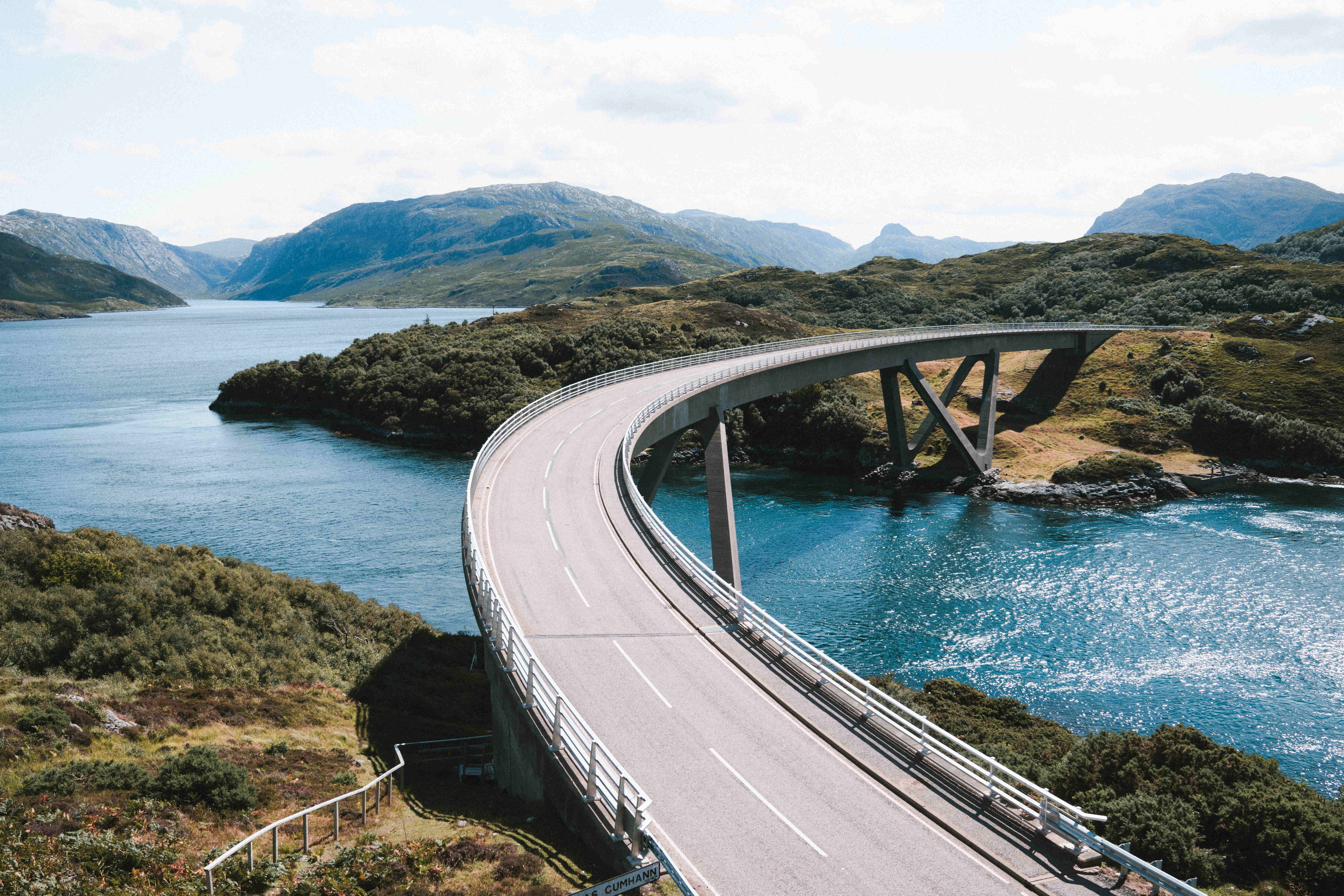
The end of Assynt is marked by the Kylesku Bridge, just north of Unapool. The bridge is an understated piece of clean-lined architecture that contrasts brilliantly with the rugged peaks and rocky shorelines of the sea loch. A little carpark lies on the North Side of the bridge, allowing you to pull over and marvel at the engineering prowess exhibited in such a remote part of the country. To your right, lies the last of the iconic pyramid-like Assynt Peaks.
As the road winds further and further north, the landscape begins to shift. The land starts to flatten out and the surroundings turn a richer shade of green. As you head down the road towards Durness, with the North Sea heaving more and more into view, you will soon enter a wholly different section of the NC 500. This section is defined by its stunning beaches and crystal-clear blue waters, limestone caves and the backdrop of the Highlands to the South. On a fine day, you would be forgiven for thinking that you have arrived on a tropical island, but the freezing cold waters and biting northern winds would likely bring you back to reality.
As you drive along the very top of mainland Britain, there are a number of must stops. The first is one of the beaches just along the road from Durness, there are three to choose from (marked on the map), but parking is definitely most convenient at the first. If the weather is good, you should definitely brave a dip and marvel at how clear and beautiful the waters are, but do make sure to have a warm towel nearby! Beaches don’t get much better in Britain than in this part of Northern Scotland.
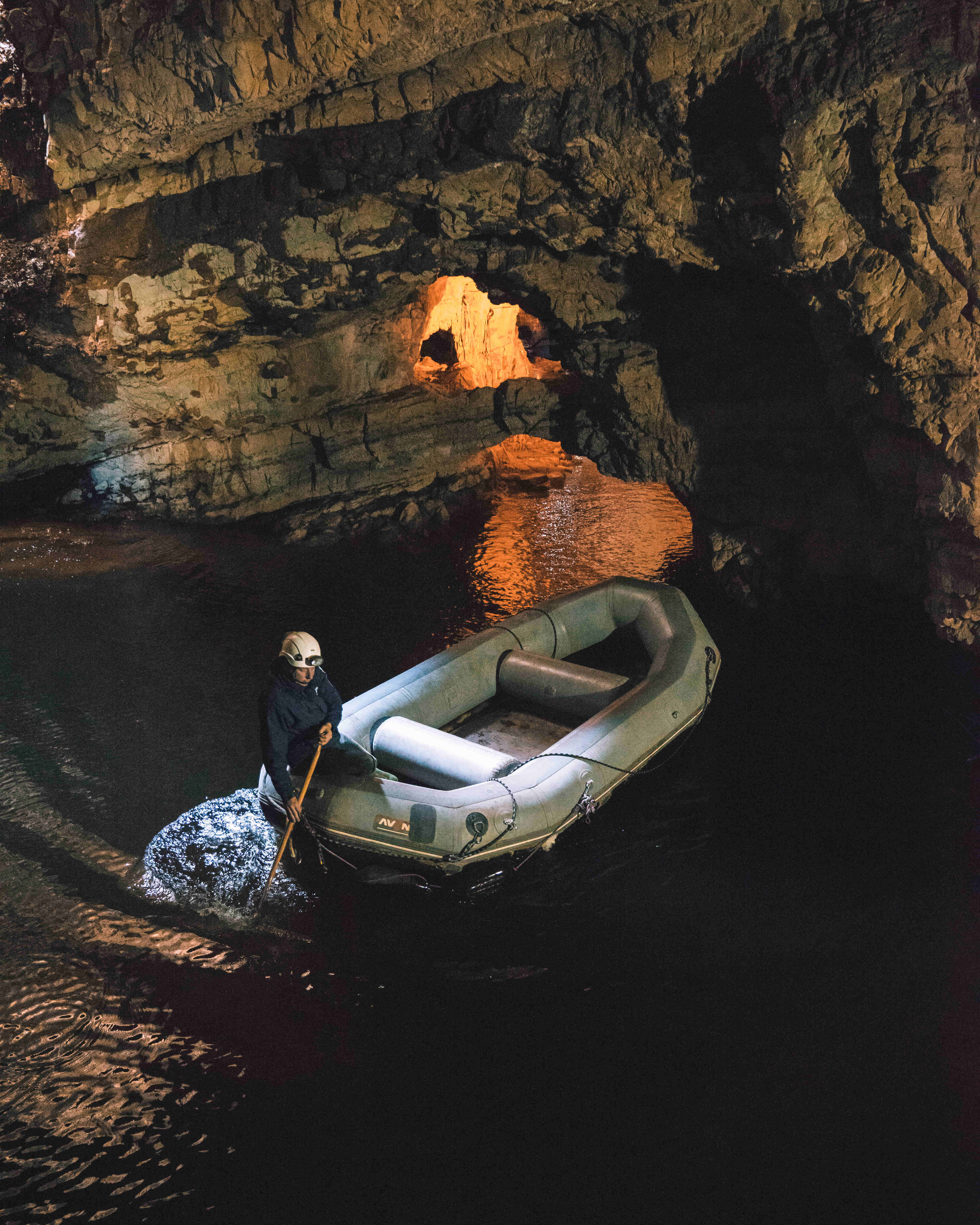
Another spot to visit, just on the outskirts of Durness, is Smoo Cave. A limestone cave, formed by a combination of freshwater and seawater, has an incredibly unique geological history within the UK. A short walk down from the road, you are greeted with the huge mouth of the cave. The cave is open 365 days a year, and has a walkway into the waterfall chamber, where you can marvel at the huge limestone cavern and the majestic 20m waterfall. In addition, from 1st April to the end of September, a local guide runs tours of the inner caves for a reasonable rate.
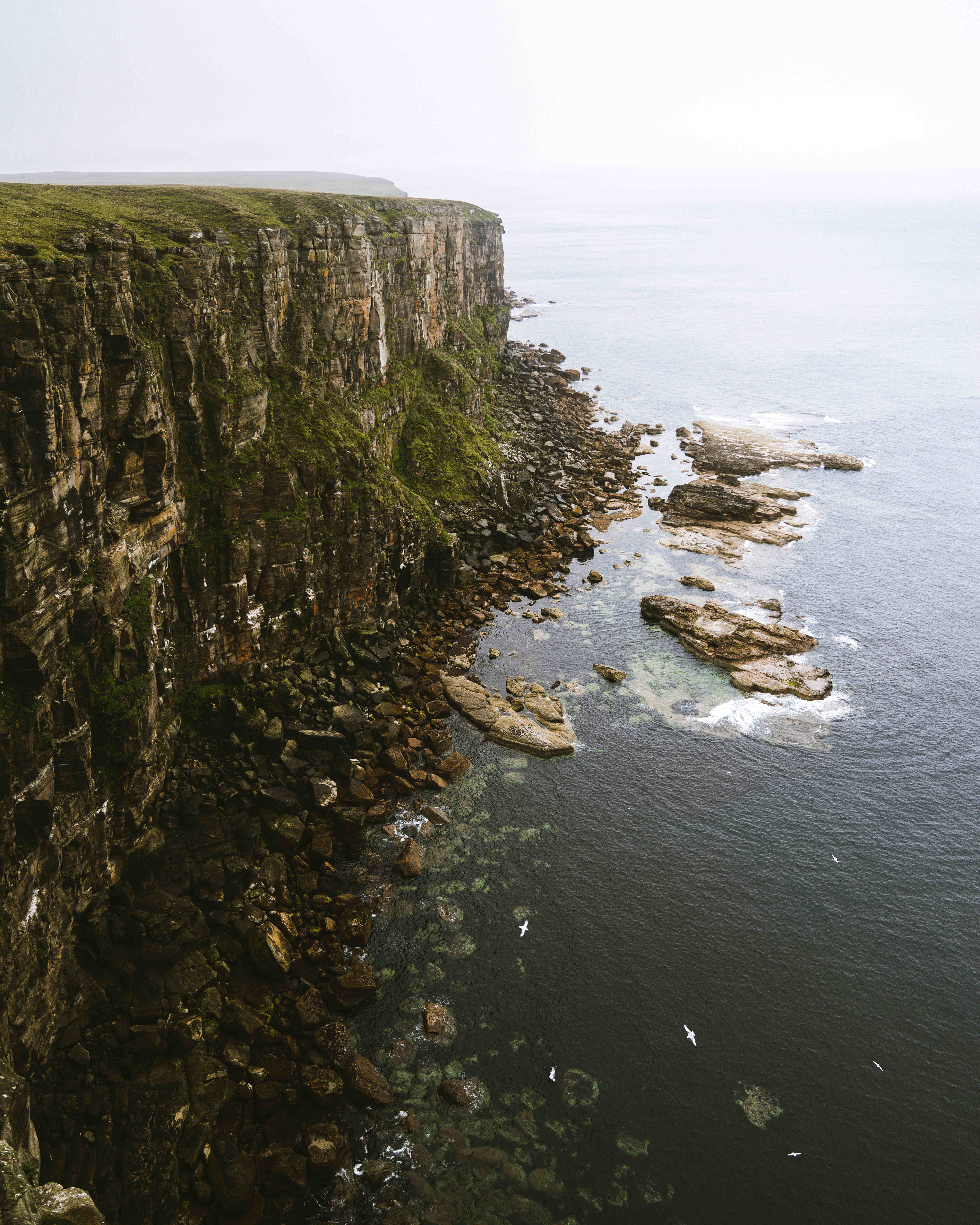
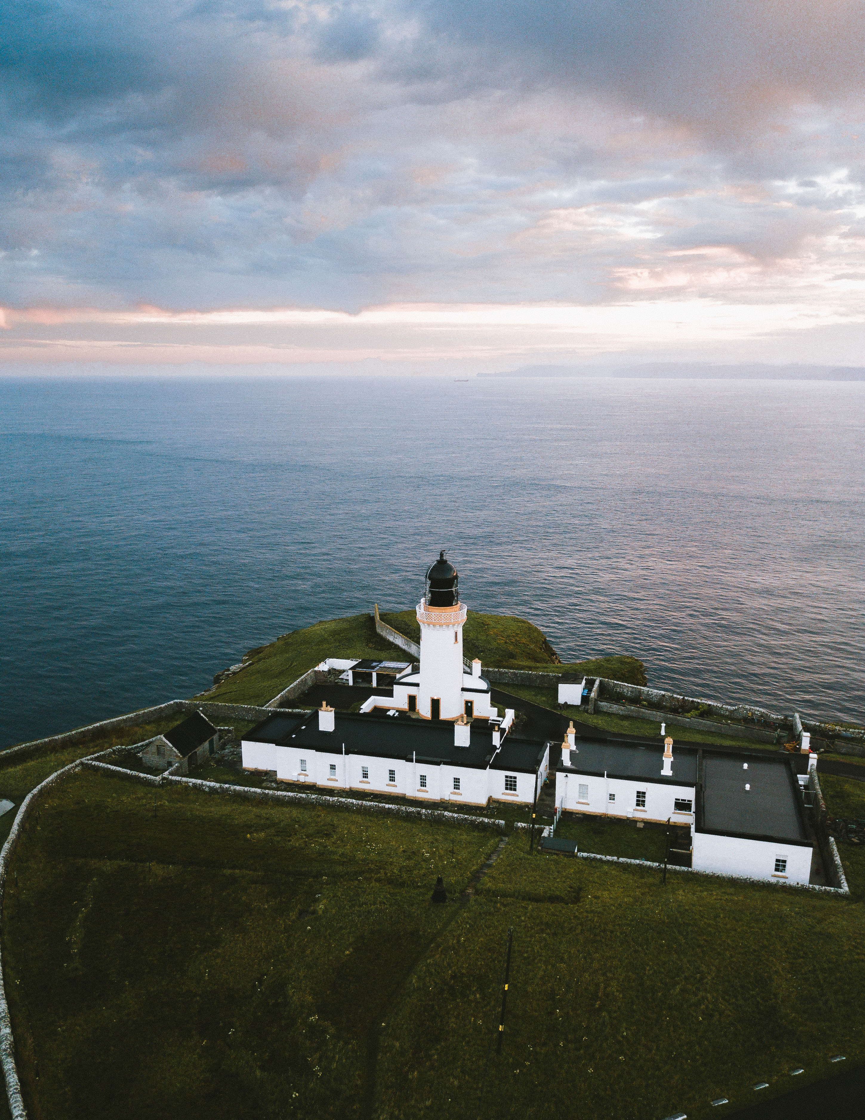
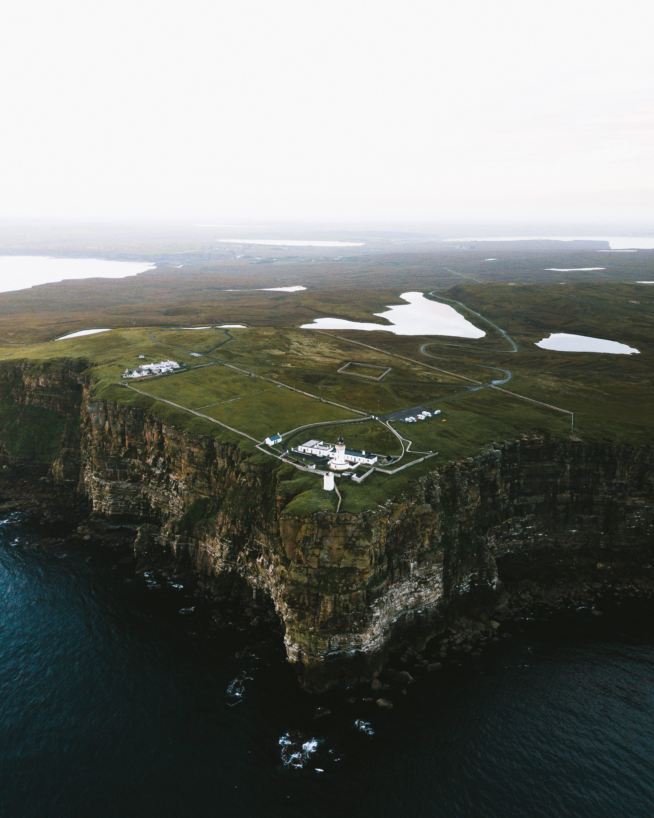
Next stop on most people’s bucket list is likely John O’Groats, the most North-Easterly part of mainland Britain. It is also often the starting or finishing point for those adventurous cyclists that traverse the length of mainland Britain, typically from Land’s End to John O’Groats. However, I would implore everyone to pay a visit to Dunnet Head first, the true most northerly point of mainland Britain. Home to a magnificent lighthouse with expansive views over to the southern tip of the Isles of Orkney, Dunnet Head offers a point to reflect on how far North you have truly come and how much beauty you have seen along the way. It’s a wild and untamed landscape on a peninsula that sticks out into the North Sea. Home to stunning sea cliffs and coastal grasslands, Dunnet Head is an RSPB site, so keep an eye out for puffins, fulmars, guillemots, razorbills and kittiwakes.
Of course a stop at John O’Groats is obligatory on this road trip, but rather than the lighthouse and the most North-Westerly point, the biggest point of interest here is probably the Duncansby stacks. A short walk around the lighthouse and the stacks open up in front of you. These pointy, rugged masses of rock that stick out of the North Sea mark an apt turning point of this journey, as you finally turn south after miles and miles of heading northbound.
The final stretch from John O’Groats to Inverness is different again. A striking contrast between the east and west coasts is clearly evident. The west is dominated by lochs and rugged peaks, whereas the east is home to rolling farmlands, beautiful coastal towns and a rich history with iconic castles dotted along the coastline. The ruins of Castle Sinclair Girnigoe, just north of Wick are well worth a stop to explore. Dunrobin castle, a stately home that looks straight out of Disney film with its towering conical spires, is also worth a stop. Boasting beautiful gardens and a magnificent castle, a few hours can definitely be spent wandering the grounds of Dunrobin.
On the final stretch back to Inverness, which sees the completion of the 500-mile circuit, the road widens and you may welcome back the multi-lane highway. This would be the perfect chance to reflect on your time spent on the entire route. The NC 500 offers something for everyone, just a flick of an indicator and you can be off hiking a mountain, swimming on a remote beach, exploring the ruins of an ancient castle or prehistoric bone caves, or relaxing on the harbour-side with some delicious fish and chips. A glimpse into the very heart and soul of Scotland, as well as some of Britain’s remaining spots of great wilderness – the NC 500 is definitely one not to be missed.
A map of the NC 500 route and locations of points of interest mentioned above can be found here, along with a few extras not mentioned in the article.